
I have spent way too many hours looking up this ride and freaking myself out. The last straw was getting elevation maps from my ride last Sunday to compare to tomorrow’s ride. Here’s what I found:
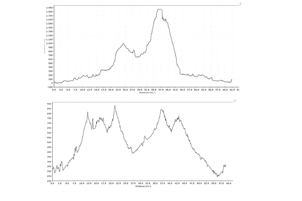
The bottom one is last Sunday, the top is tomorrow. The horizontal axis covers the same number of miles. The difference between them is that bottom one goes from 200 Ft to 900 ft whereas tomorrow’s ride goes from 0 to 1300 ft. Total elevation gain is the same. However, the grade is much, much steeper. But I can do this. I can do this.
The ride with the wild turkeys had a 2+ mile climb at 4%. I don’t think this one is any worse although it may be longer.
Can you spell O-B-S-E-S-S-I-N-G??
I can do this, right?? Just.keep.pedaling.
I’m nervous but excited.

You can so do this. Dare to do “mighty things.” No beige allowed.
Be strong, be confident. You can do this.
Be the little engine that could. “I know I can. I know I can”Good luck tomorrow. May the wind be always at your back and the road rise up to meet you.
Relax!! You will do great!! Go get them.
Relax!! You will do great!! Go get them.
I bet you did it!
I bet so too…and this is the very reason I don’t have charts and graphs of elevation changes of the course I am going to ride!
I am sure that you *can* do it, and by now you already have. I hope it was fun.
ouch. that’s gonna hurt for awhile.did you do it?